
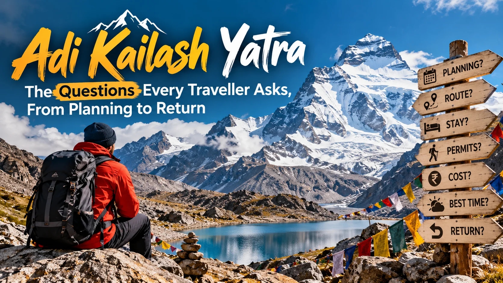
Adi Kailash Yatra: The Questions Every Traveller Asks, From Planning to Return
If you are planning the Adi Kailash Yatra, questions arrive at every stage. Do I need a permit? How high does it go? Will my phone work? What if I feel unwell? Am I even fit enough?
This guide answers those questions in the order a pilgrim usually asks them, from the first search to the drive home. Answers are short first, then detailed.
Conditions in the Vyas Valley change with weather, landslides and government orders. We flag anything you should confirm before you travel. Details were last checked on 29 September 2026.
Adi Kailash Yatra at a glance
| Item | Quick answer |
| What it is | A Shiva pilgrimage to Adi Kailash (also called Chhota Kailash or Baba Kailash) in Uttarakhand |
| Location | Vyas Valley, Pithoragarh district, near the India–Tibet border |
| Peak height | About 5,945 m (19,505 ft) |
| Key base towns | Pithoragarh, Dharchula, Gunji |
| Darshan point | Jolingkong, with a short walk to Parvati Sarovar |
| Permit | Inner Line Permit (ILP) required |
| Typical season | Roughly May–June and September–October, weather permitting |
| Typical length | About 7–10 days, depending on your starting city |
| Who it suits | Fit pilgrims with medical clearance; not for those with serious heart, lung or altitude problems |
What is the Adi Kailash Yatra, and why do pilgrims go?
The Adi Kailash Yatra is a pilgrimage to Adi Kailash, a sacred Himalayan peak in Uttarakhand believed to be an abode of Lord Shiva and Goddess Parvati. Pilgrims travel to Jolingkong for darshan, and most also visit Om Parvat.
Adi Kailash is often called Chhota Kailash because its shape reminds many devotees of Mount Kailash in Tibet. It is counted among the five sacred Kailash peaks known as Panch Kailash. It stands at about 5,945 m.
The Adi Kailash tour is popular with people who want a Kailash-linked pilgrimage within India, with far less paperwork than an international route. Since the road reached Jolingkong, the old multi-day trek from Dharchula is no longer required, though the journey is still physically demanding because of altitude.
Is the Adi Kailash Yatra the same as the Kailash Mansarovar Yatra?
No. They are two different pilgrimages. Adi Kailash is in Uttarakhand, India. The Kailash Mansarovar Yatra goes to Mount Kailash (6,638 m) and Lake Mansarovar in Tibet, China, and needs international travel arrangements.
The two are often confused because of the similar names and because both are approached through Dharchula and the Lipulekh direction in some cases.
| Adi Kailash Yatra | Kailash Mansarovar Yatra | |
| Country | India (Uttarakhand) | Tibet, China |
| Main sacred sites | Adi Kailash, Parvati Sarovar, Gauri Kund, Om Parvat | Mount Kailash, Lake Mansarovar |
| Permit | Inner Line Permit from Pithoragarh district administration | Government of India yatra (organised by the Ministry of External Affairs) or private tours via Nepal, with Chinese permits |
| Who can go | Indian citizens (see permit section) | Depends on route and organiser |
| Highest area you reach | About 4,400–4,600 m at Jolingkong | Dolma La pass on the Kailash circuit is about 5,630 m |
| Typical duration | About 7–10 days | About 2 weeks or more |
| Physical walking | Short walks at the top | Includes the long Kailash circuit |
Om Parvat is the one place that links both. It is viewed from Nabhidhang, which lies on the Lipulekh route used by the Kailash Mansarovar Yatra and is also visited on the Adi Kailash circuit.
Confirm before you plan: The Ministry of External Affairs announces Kailash Mansarovar Yatra dates and routes each year. Check its official site for the current year.
Does the Adi Kailash Yatra include Kailash Parikrama?
No. The standard Adi Kailash Yatra does not include the Kailash Parikrama, which is the roughly 52 km circuit around Mount Kailash in Tibet. Adi Kailash involves darshan at Jolingkong and short walks to Parvati Sarovar and Gauri Kund.
Kailash Parikrama (also called the Kailash Kora) is done around Mount Kailash itself, usually over about three days as part of the Kailash Mansarovar Yatra.
Some operators use the word “parikrama” loosely for the Adi Kailash circuit. If a package promises it, ask exactly what the walk is: distance, days, altitude and where it starts and ends.
Is the Adi Kailash Yatra open right now, and when is the best time to go?
The best time is generally May–June and September–October. July and August are the monsoon months, when landslides often disrupt the road. Winter closes the higher route. Always confirm the current status with the Dharchula SDM office before booking non-refundable travel.
What happened in 2026 shows why this matters:
- The 2026 season opened on 1 May.
- Permit issuance was suspended in early July after monsoon landslides and road damage on the Dharchula–Gunji road.
- A key bridge at Kulagad was washed away twice, which delayed the planned 15 September restart.
- A local news report dated 20 September 2026 says the district administration resumed permit issuance for the second phase, expected to continue until November or until snowfall in the high Himalaya.
Practical tips:
- Choose September–October for generally clearer skies, but expect cold nights and early snow risk.
- Choose May–June for opening-season conditions, but expect crowds and patches of snow higher up.
- Build at least one buffer day into your plan for weather or road closures.
Who can do the Adi Kailash Yatra, and can beginners go?
Fit beginners can usually do it, because most of the route is by vehicle and the daily walks are short. But altitude affects everyone, so you need a medical fitness certificate and realistic expectations. The Inner Line Permit is generally described as for Indian citizens.
Points to know:
- Age: Guides commonly mention 18 as a minimum, and many operators set a practical upper limit around 70. Rules and operator policies vary, so check with the administration or your tour company.
- Health: People with heart disease, lung disease, uncontrolled blood pressure or diabetes, or a history of severe altitude illness should get specific medical advice first.
- Foreign nationals and OCI holders: Most guides say the Adi Kailash permit is for Indian citizens only. If you hold a foreign passport, ask the district administration directly before planning.
How difficult is the Adi Kailash trek, and how fit do I need to be?
It is moderate for fit people, mainly because of altitude and long, bumpy drives rather than long walking. You should be able to walk 2–4 km at a slow pace at around 4,500 m and cope with days of rough mountain roads.
The hardest parts are:
- Long drives on narrow, landslide-prone mountain roads
- Sudden gain in height between Dharchula (around 900 m) and Gunji (around 3,200 m)
- Cold, thin air at Jolingkong and Nabhidhang
- Basic facilities
Some operators still describe the overall experience as “moderate to difficult”. The walk itself is short. The challenge is how your body handles the height.
How to prepare (4–6 weeks before):
- Walk briskly 30–45 minutes daily, and add stairs or gentle hills
- Practise breathing steadily while walking uphill
- Get a medical check-up and discuss altitude with your doctor
- Break in your shoes before you leave
What permit do I need for the Adi Kailash Yatra?
You need an Inner Line Permit (ILP). The route lies in a restricted border area near Tibet, and the permit is issued by the Pithoragarh district administration (through the SDM Dharchula). You must carry it and show it at checkpoints.
The ILP is also called the Adi Kailash permit or Om Parvat permit. It records your identity and the days you may stay in the restricted zone.
Checkpoints on the route, including ITBP posts, verify permits and documents. Gunji is widely described as the most important checkpoint.
Which documents should I keep with me?
Requirements can change, but travellers are commonly asked for:
- Original government photo ID (Aadhaar, voter ID or passport) plus photocopies
- Passport-size photographs
- Medical fitness certificate from a registered doctor (a format is provided on the district portal)
- Signed affidavit / undertaking in the prescribed format
- Printed ILP and payment receipt
- Your tour booking details, if travelling with an operator
- Emergency contact and medical information sheet
Make sure the name on every document matches exactly. Mismatches are a common cause of delay.
How do I apply, and how long does it take?
Apply through the official Pithoragarh district inner-line pass portal, or through your registered operator. The portal states that approval usually takes about 24–48 hours, but always apply well in advance.
Steps on the district portal, in short: register and log in, fill in your details, upload ID, photo, medical certificate and affidavit, pay the nominal fee, wait for approval, then download and print your permit.
Some private guides say the permit must be collected in person at Dharchula or Pithoragarh. Because processes change, confirm the current method with the SDM Dharchula office or on the official portal before you travel.
Beware of fake permits. The administration has warned about them.
Should I book a tour or travel on my own?
Most pilgrims book through an operator because permits, 4×4 vehicles, homestays and weather backup are hard to arrange alone. Solo travel is technically possible, but authorities and experienced operators discourage it.
Questions to ask any operator:
- Who applies for the ILP, and when?
- How many nights at Gunji for acclimatisation?
- What vehicles are used beyond Dharchula?
- What happens if the road closes?
- Is there oxygen and a first-aid kit with the group?
- What are the refund and rescheduling terms if permits are suspended?
Talk to Divine Trail about planning your journey
What is the Adi Kailash route, stop by stop?
The standard Adi Kailash route runs Kathgodam or Tanakpur → Pithoragarh → Dharchula → Gunji. At Gunji it splits: one road goes to Kuti and Jolingkong for Adi Kailash, another to Nabhidhang for Om Parvat.
| Stage | Approx. altitude* | What to expect |
| Kathgodam / Tanakpur | Foothills | Railhead; road journey into Kumaon begins |
| Pithoragarh | About 1,500 m | District headquarters; common overnight stop |
| Dharchula | About 900 m | Last major town: ATM, pharmacy, permit checks |
| Tawaghat, Budhi, Garbyang, Napalchu | Rising | Narrow road along the Kali (Mahakali) river; landslide-prone |
| Gunji | About 3,200 m | Key checkpoint; acclimatisation stop; homestays |
| Kuti | About 3,600 m | Last village before Jolingkong |
| Jolingkong | About 4,400–4,600 m | Road-head and base for Adi Kailash darshan |
| Nabhidhang | About 4,300 m or higher | Viewpoint for Om Parvat |
*Altitudes are approximate and differ between sources. Treat them as guides, not exact readings.
Kathgodam or Tanakpur to Pithoragarh
Most groups start from Kathgodam (near Haldwani) or Tanakpur, the nearest railheads for this route, and drive into the Kumaon hills. From Delhi, this stretch is a long road day, often split with a night halt.
Pithoragarh to Dharchula
Dharchula is about 92 km north of Pithoragarh. This is the last reliable place for ATM, pharmacy and mobile network on this route, so do final shopping here.
Dharchula to Gunji
This is roughly 90 km on a mountain road along the Kali river, gaining about 2,300 m in height. Many operators use 4×4 vehicles beyond Dharchula. This is where road blocks are most common in the rains.
Gunji to Kuti and Jolingkong (Adi Kailash)
From Gunji the road goes via Kuti village to Jolingkong. Reports put the drive at roughly 3–6 hours one way, depending on which source and conditions you follow. From Jolingkong you walk a short distance to the Parvati Sarovar and the Shiva–Parvati temple, and further to Gauri Kund.
Gunji to Nabhidhang (Om Parvat)
The Nabhidhang branch passes Kalapani and is usually covered as a separate outing from Gunji, on the same day or the day after Adi Kailash.
Helicopter option: Some operators offer helicopter flights between Pithoragarh, Dharchula or Gunji and the darshan points, subject to availability and separate clearances. Ask your operator what is actually confirmed.
How many days does the Adi Kailash tour take?
Most itineraries take about 7–10 days by road from Kathgodam, Tanakpur or Delhi, including acclimatisation and a buffer day. Shorter helicopter-assisted options exist but depend on weather and availability.
A common pattern:
- Reach Kathgodam or Tanakpur, drive to Pithoragarh or nearby
- Drive to Dharchula
- Drive to Gunji (acclimatise)
- Adi Kailash darshan via Kuti and Jolingkong, return to Gunji
- Om Parvat darshan via Nabhidhang, return
- Buffer / rest day
- Drive back toward Dharchula and Pithoragarh
- Return to Kathgodam or Tanakpur
Never plan an onward flight or train for the same evening you expect to come down the mountain.
How high is the Adi Kailash Yatra, and how do I avoid altitude sickness?
You reach roughly 4,400–4,600 m at Jolingkong. That is high enough for altitude sickness. Rest at Gunji, drink water regularly, walk slowly, avoid alcohol, and tell your guide about any symptoms early.
Height gain is fast on this route. Dharchula to Gunji alone is a large jump.
Simple habits that help:
- Acclimatise: Spend a night or more at Gunji rather than rushing up.
- Drink water steadily, and eat light meals.
- Move slowly. Do not run or carry heavy loads at height.
- Avoid alcohol and smoking.
- Ask your doctor whether you should carry any altitude-related medicine. Do not self-prescribe.
Basic health screening is reported at Gunji, and pilgrims showing serious distress may be stopped from going higher. Follow such instructions.
What should I do if I feel breathless?
Stop, sit, breathe slowly and rest. If breathlessness continues at rest, or comes with a headache, vomiting, confusion or loss of balance, tell your guide immediately and move to a lower altitude.
Warning signs to treat seriously:
| Symptom | What to do |
| Mild headache, tiredness, poor sleep | Rest, drink water, do not go higher until it improves |
| Repeated vomiting, worsening headache | Inform your guide; descend |
| Breathlessness at rest, wet cough | Emergency; descend and seek medical help |
| Confusion, stumbling, extreme drowsiness | Emergency; descend and seek medical help |
Do not hide symptoms to avoid missing the darshan. Going higher with worsening symptoms is dangerous.
What should I pack for the Adi Kailash Yatra?
Pack warm layers, a windproof and waterproof jacket, sturdy shoes, sun protection, a torch, personal medicines and cash. Nights can be cold even in good weather season.
Clothing
- Thermal inner layers (top and bottom)
- Fleece or light down jacket
- Waterproof and windproof outer jacket
- Warm cap, gloves, socks (several pairs)
- Comfortable trekking or hiking shoes with good grip (no new shoes)
- Sun hat, UV sunglasses
Documents
- Original ID plus photocopies
- Printed ILP, medical certificate, affidavit
- Booking details, emergency contacts
Health and safety
- Personal prescription medicines with a doctor’s note
- Basic first-aid kit, sunscreen, lip balm
- Hand sanitiser, tissues, and toilet essentials
Other
- Power bank and charging cables
- Torch or headlamp
- Reusable water bottle
- Snacks (nuts, dry fruit, chocolate)
- Cash in small notes (no ATMs beyond Dharchula)
- Rain cover for your bag; trekking pole if you use one
Keep a small day bag for darshan days and leave the rest in the vehicle or homestay.
What is the weather like, and what if it changes suddenly?
Weather in the Vyas Valley can shift from sunshine to cloud, rain or snow within hours, and temperatures fall sharply above Gunji. Start early, carry layers and follow your guide’s advice about turning back.
Key points:
- Monsoon (July–August): Heavy rain, landslides and river swelling. Generally the least suitable period.
- Post-monsoon (September–October): Often clearer views, colder nights, and risk of early snow.
- Winter: Road generally closes beyond Dharchula, and Vyas Valley villages empty out as residents move down.
- Any season: Cloud and fog can hide Adi Kailash and Om Parvat.
Check the IMD forecast for Pithoragarh and Dharchula before departing, and ask your operator for a same-day update on the road.
How much walking is there on the Adi Kailash Yatra?
Much less than it used to be. Since the road was extended, the walk from Jolingkong to Parvati Sarovar is generally reported as about 1–3 km each way, and Gauri Kund about 3–4 km, though sources vary.
The old trek of around 200 km from Dharchula is now optional history. Today:
- Jolingkong to Parvati Sarovar and the temple: short but high-altitude, with some muddy or rocky sections and railings in places.
- Gauri Kund: longer and steeper.
- Om Parvat at Nabhidhang: viewpoint reached mainly by road.
Mules or porters are reported at Jolingkong for some walks. Ask your operator whether they are available and how they are arranged.
Even a short walk feels hard at 4,500 m. Go slowly, take breaks and do not compare your pace to others.
Where will I find food, water, toilets and a place to stay?
Expect basic facilities. Hotels are available up to Dharchula. Beyond that, stays are mostly homestays, KMVN huts and seasonal camps in villages such as Gunji, Nabhi and Kuti. Meals are simple, mostly vegetarian.
- Stay: Book early for May–June and peak September dates. Availability varies by season.
- Food: Simple home-style meals. Carry snacks for long drives.
- Water: Carry a bottle; treat or use safe water as advised by your guide.
- Toilets: Basic and sometimes shared. Carry tissues and hand sanitiser.
- Shops and medicine: Stock up in Dharchula. Supplies are limited above it.
Do not expect hotel-style comfort. Warm bedding is usually provided, but ask what is included.
Will my phone work? What about charging and cash?
Mobile network becomes very limited after Dharchula. BSNL is generally reported to work patchily, while Jio and Airtel often do not. Tell family your plan in advance, carry a power bank and keep cash.
- Network: Coverage varies by source and by spot. Do not depend on any network at Jolingkong or Nabhidhang.
- Emergency contact: ITBP posts along the route can act as informal communication points. Your guide should know how to reach help.
- Charging: Power can be limited in homestays. Charge fully in Dharchula and carry a power bank.
- Cash and UPI: Do not assume UPI or ATMs beyond Dharchula.
- Downloads: Save offline maps, tickets and documents on your phone.
You can check operator coverage claims on the TRAI service-provider information, but remember that mountain coverage changes.
I’m tired and unsure. Should I continue?
If you are tired but stable, rest and reassess. If you have worsening headache, vomiting, breathlessness at rest, confusion or poor balance, stop and go down. The darshan is not worth risking your health.
A simple check:
- Rest 15–20 minutes and drink water.
- Ask: Is my breathing settling? Can I talk normally? Do I feel clear-headed?
- If yes, continue slowly with your guide.
- If no, stop. Turn back, or wait at a lower spot while others continue.
Devotees often say the intention matters as much as reaching the exact spot. Many can offer prayers from a lower viewpoint and still complete the yatra with a calm mind.
What will I see at Adi Kailash, and why is it sacred?
At Jolingkong you see the pyramid-shaped Adi Kailash peak, Parvati Sarovar, the Shiva–Parvati temple and Gauri Kund. Devotees associate the area with Shiva and Parvati, and with legends of the Pandavas.
Places you may hear about:
- Adi Kailash (5,945 m): Revered as one of the Panch Kailash, the five Kailash peaks.
- Parvati Sarovar: A high-altitude lake where devotees offer prayers, with a temple nearby.
- Gauri Kund: A small glacial pool near the base of the peak.
- Bheem ki Kheti: A field-like landscape linked in local tradition to Bhima of the Mahabharata.
- Kuti village: Linked in tradition to Kunti, mother of the Pandavas.
- Vyas Gufa / Kalapani: Locations associated with sage Vyasa and a Kali temple respectively, seen on the way to Nabhidhang.
Traditions and stories vary by community and by guide. Ask local residents to share the significance in their own words.
Respectful conduct: Keep the area clean, avoid loud music, follow local customs and carry your waste back.
What is Om Parvat, and when is the “Om” visible?
Om Parvat is a mountain near Nabhidhang whose snow-filled ridges form a natural “Om” shape. Visibility depends on clear weather, and the pattern is often described as most striking after the first snows.
Om Parvat is viewed from Nabhidhang, on the Lipulekh side of the valley. It is often visited on a separate day from Adi Kailash.
Cloud and fog can hide it in any season, and some travellers report not seeing the full symbol. Plan a buffer day and treat the sighting as a blessing, not a guarantee. Its height is commonly quoted around 6,191 m; sources vary.
What if the road is blocked or something goes wrong?
Stay calm and follow your guide, the local administration and ITBP instructions. In India, dial 112 for emergencies where there is network. Carry a buffer day and keep emergency contacts written down.
Common risks and responses:
| Situation | What to do |
| Landslide blocks the road | Wait at a safe place; do not cross unstable slopes; BRO clears roads |
| Bridge damaged or washed away | Follow administration guidance; plans may change |
| Medical emergency | Inform guide; descend; contact nearest ITBP post or medical help |
| No phone network | Use your guide’s arrangements; note ITBP checkpoints |
| Permit suspended | Contact operator and SDM Dharchula; ask about rescheduling |
Before you leave:
- Share your itinerary and permit copy with family
- Ask your operator about evacuation and refund policies
- Check travel insurance terms for high-altitude cover
What happens after the darshan? The return journey
After Adi Kailash and Om Parvat you drive back to Gunji, Dharchula and Pithoragarh, then on to Kathgodam or Tanakpur. Going down usually feels easier, but the road is still long and can be affected by weather.
Tips for the return:
- Expect to be tired and dusty; rest at Dharchula or Pithoragarh.
- Keep your ILP and ID until you exit the restricted zone.
- Avoid booking a same-day train or flight from Kathgodam, as delays are common.
- Drink water and eat light; altitude effects usually ease as you descend.
Can I do the Kailash Mansarovar Yatra after Adi Kailash?
Yes, many pilgrims do both, but treat them as separate journeys with separate permits and fitness needs. Adi Kailash can be a good high-altitude trial run, but it is not a guarantee you will cope with the much higher Kailash circuit.
If Mount Kailash and Kailash Parikrama are your long-term goal, note how your body responded at Gunji and Jolingkong, and discuss it with your doctor. Check the Ministry of External Affairs and your chosen operator for current-year Kailash Mansarovar Yatra details.
Also Read :
Conclusion
The Adi Kailash Yatra rewards careful planners. Get your Inner Line Permit and medical certificate in order, allow time at Gunji to adjust to altitude, pack for cold and weather changes, and keep a buffer day for the road.
You don’t need to be a mountaineer, but you do need to respect the height, listen to your body and follow local guidance. If you are comparing this with the Kailash Mansarovar Yatra or wondering about Kailash Parikrama, remember they are separate journeys with separate preparation.
Conditions, permits and roads in the Vyas Valley can change quickly. Confirm the latest status with the Dharchula SDM office or the district portal before you travel.
FAQs
1. Is the Adi Kailash Yatra difficult?
It is moderate for fit people. Most travel is by road, and the walks at Jolingkong are short, but altitude of roughly 4,400–4,600 m, cold and rough roads make it demanding. Medical clearance and slow, steady pacing are essential.
2. Can beginners do the Adi Kailash Yatra?
Yes, if they are reasonably fit and medically cleared. Beginners should choose a schedule with acclimatisation time at Gunji, prepare with daily walking, and travel with an experienced operator.
3. What should I carry during the Adi Kailash Yatra?
Carry thermal layers, a windproof and waterproof jacket, sturdy shoes, gloves, cap, sunscreen, sunglasses, torch, power bank, personal medicines, ID with photocopies, your printed ILP and enough cash in small notes.
4. What should I do if I feel breathless at high altitude?
Stop, sit and breathe slowly. If breathlessness continues at rest, or comes with vomiting, confusion or loss of balance, inform your guide immediately and descend. Never continue upward with worsening symptoms.
5. Is mobile network available during the Adi Kailash Yatra?
Only patchily. Network becomes limited after Dharchula, with BSNL reported to work in some places and other operators often not. Assume no reliable signal at Jolingkong and Nabhidhang, and inform family in advance.
6. Where can I find food and accommodation?
Hotels are available up to Dharchula. Beyond that, homestays, KMVN huts and seasonal camps operate in villages like Gunji, Nabhi and Kuti. Meals are simple and mostly vegetarian. Book early in peak months.
7. What documents should I keep with me?
Keep original photo ID with photocopies, passport-size photos, your printed Inner Line Permit, medical fitness certificate, signed affidavit, booking details and emergency contacts. Checkpoints may ask to see them.
8. Is Adi Kailash the same as Kailash Mansarovar?
No. Adi Kailash is in Uttarakhand, India, and is reached with an Inner Line Permit. Mount Kailash and Lake Mansarovar are in Tibet, China, and need a separate yatra with different permits, route and duration.
9. Does the Adi Kailash Yatra include Kailash Parikrama?
No. Kailash Parikrama is the roughly 52 km circuit around Mount Kailash in Tibet. Adi Kailash involves darshan at Jolingkong and short walks to Parvati Sarovar and Gauri Kund. Ask operators exactly what any “parikrama” claim means.
10. Is the Adi Kailash Yatra open in monsoon or winter?
It is usually best avoided in July–August due to landslides, and the higher route generally closes in winter with snow. Opening and closing depend on weather and administration orders, so confirm before you book.